Jogira Fm
Type Locality and Naming
OUTCROP: The type section is located half a mile Jogira Talav. [Original Publication: Shrivastava, B.P., and Srinivasan, S., 1962: Geology of the area around Bap Nagaur, Western Rajasthan: Progress Report for the year 1961-62. ONGC Report (Unpublished)]
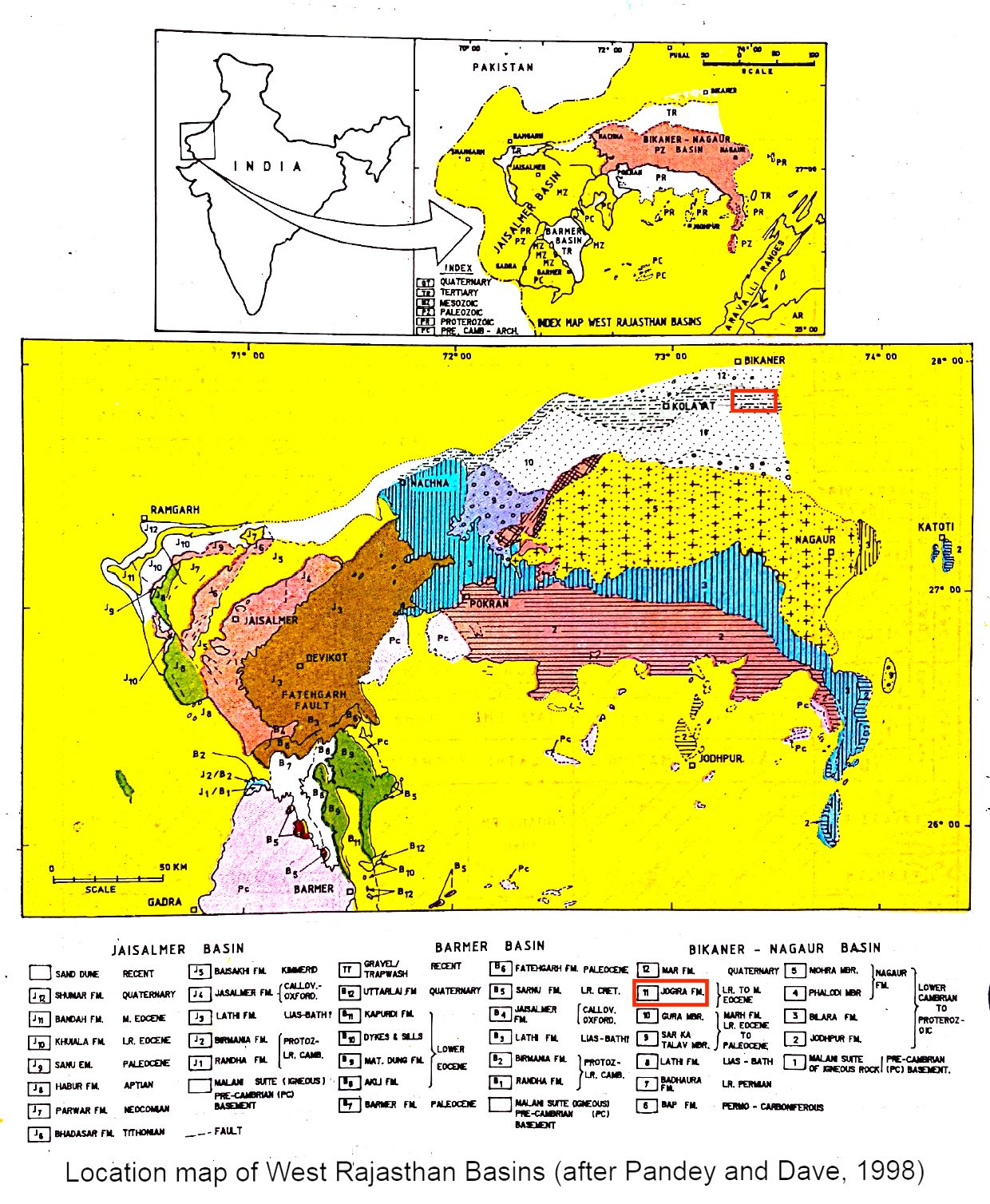
[Figure 1: Location map of West Rajasthan Basins (after Pandey and Dave, 1998)]
Synonyms: The outcropping Eocene sediments of Kolayat atehsil have been referred to by the La Touche (1897) and Singh (1953), as “Eocene of Bikaner” and “Eocene of Kolayat” respectively without a definite name. Shrivastava and Srinivasan (1962) designated this sequence as “Jogira Formation” after the locally Jogira Talao. Singh (1969, 1971) divided these sediments into Kolayat and Marh and Bikaner stages. Khosla (1971, 1973) extended Khuiala amd Bandah formations of Jaisalmer basin to Bikaner-Nagaur basin without establishing their continuity and lithological similarity. Kulshreshta et al (1989) have followed the classification of Singh.
Lithology and Thickness
Marl and Limestone. In the type locality the lithology is represented by alternation of marl, fuller’s earth and foraminiferal limestone. A thickness of about 170 m has been estimated near Jogira Talao section (Shrivastava and Srinivasan, 1962).
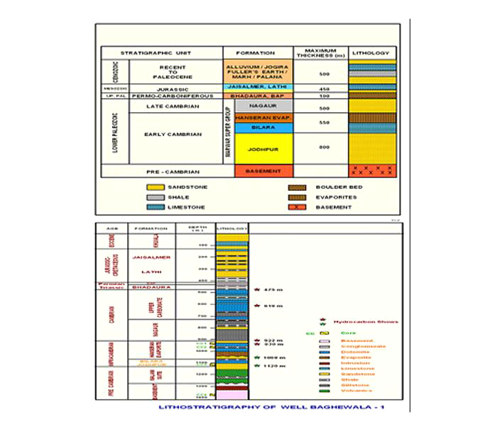
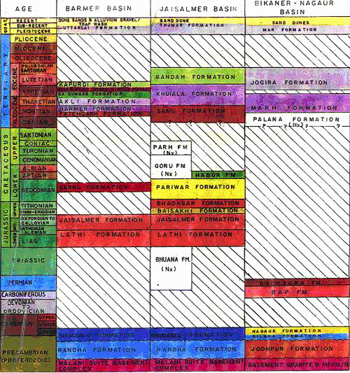
[Figure 2: Generalized and Subsurface Stratigraphy of Bikaner-Nagaur Basin ((from dghindia.gov.in)]
Relationships and Distribution
Lower contact
Lower boundary disconformably overlies the sandstone of Marh Fm (Early Eocene).
Upper contact
Major hiatus. Upper boundary is unconformable with overlying Mar Fm (Quaternary).
GeoJSON
Fossils
Foraminifera are recorded in this formation and the characteristic ones are: Morozovella formosa formosa, M. subbotinae, Pseudohastigerina wilcoxensis, Discocyclina sella, Fasciolites elliptica, Truncorotaloides rohri, T. collactea, Morozovella lehneri, Globigerina eocaena and Chilogenumbelina cubensis.
Age
Depositional setting
Additional Information


